
Due to its geography and climate, densely populated Switzerland is often affected by water-related hazards such as floods or debris flows, landslides, rockfalls and avalanches. Strong earthquakes are rare, but, as history shows, they can occur and represent one of the biggest risks. Due to population growth, the expansion of settlements and infrastructure, the rise in mobility, and the effects of climate change (e.g. extreme precipitation events), risks due to natural hazards are increasing.
Text: Dorothea Wabbels
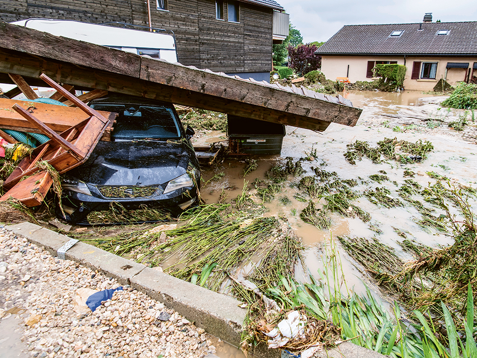
© ky
Switzerland lies in a temperate climate zone at the heart of Western Europe, bordering on France, Germany, Austria, Liechtenstein and Italy. Its territory totals 41,285 square kilometres (km2), of which almost two thirds are located in the Alpine region. The intensively developed residential and economic zone is concentrated on the relatively flat Swiss Plateau, which accounts for just 23 percent of the country’s territory. Nestled between the Jura Mountains in the North West and the foothills of the Alps in the South, this plain, which ranges from 50 to 100 kilometres in width, extends in a north-easterly direction from Lake Geneva to Lake Constance.
The hazard situation in Alpine Switzerland is influenced by the significant differences in altitude over a small area, and relatively high precipitation volumes compared with the rest of Western Europe. Temperature increases due to climate change are also higher compared with the rest of Europe.
Densely populated Swiss Plateau
Switzerland’s population of around 8.6 million people is concentrated in the lowlands. In addition to the industrial production centres, most important service operations, as well as the main road, rail and aviation infrastructure, all the major cities, i.e. Geneva, Lausanne, Bern, Lucerne, Zurich and Basel, are located there. With a population density of more than 350 people per km2, the Swiss Plateau is one of the most densely populated areas in Europe.
High levels of runoff
Due to the prevailing westerly winds and the country’s proximity to the Atlantic Ocean, the Mediterranean Sea and the North Sea, a lot of humid air is blown towards the Alps. Rain fronts often accumulate for days in front of this meteorological barrier, giving Switzerland above-average annual precipitation volumes of around 1,460 litres per square metre (m2). A good two thirds of this, i.e. almost 1,000 litres per m2, is discharged to other countries through an intricate network of streams and rivers. Mean water runoff in Switzerland is almost four times higher than in the rest of Europe and the world. A total of 40 billion cubic metres of water flow into the Mediterranean, the North Sea and the Black Sea via the main rivers, i.e. the Rhine, Rhone, Ticino (via the Po) and Inn (via the Danube). This explains Switzerland’s crucial role as a water reservoir for Western Europe.
Almost countrywide flood risk
Due to the extensive network of watercourses, the combined length of which totals around 65,000 kilometres, and due to the extreme differences in altitude of up to 4,000 metres over a relatively small area between the Alps and the Swiss Plateau, floods can occur almost everywhere in Switzerland. Moreover, the steepness of the terrain exacerbates erosion and therefore the risk posed by landslides and debris flows. Warmer periods, when the seasonal snow and glacier melt in the Alpine region coincide with intensive storms or orographic precipitation, are particularly critical. In this situation, rivers and lakes often break their banks and flood the valley plains.
Wide range of hazards
However, the mountain regions are significantly more vulnerable to gravitational natural hazards than the Swiss Plateau. Heavy snowfall and unfavourably structured snow cover create a risk of avalanches at high altitudes, while heavy rainfall during the warmer seasons can trigger landslides and debris flows. Rockfalls and landslides can also put both settlements and important transport routes at risk, as demonstrated, for example, by the blocking of the Gotthard motorway, a key trans-
Alpine road axis between Northern and Southern Europe, in 2006, or the disastrous rock avalanche and debris flow in 2017 at Piz Cengalo (Bondo) in Grisons. The above-average climate warming in the Alpine region and the resulting thawing of the permafrost and retreat of the glaciers will cause greater volumes of loose material to be mobilised in the future; a development, which represents an additional threat to settlements, transport routes and other infrastructure. Longer periods of drought also increase the risk of forest fires, particularly in the south of Switzerland. Overall, climate change is expected to increase the intensity of precipitation and storms, prompting the need for more measures to limit the extent of the damage caused by floods, hail and severe storms. Earthquakes tend to be a rare occurrence in Switzerland, however, when they do occur they have the greatest potential to cause damage.
Shared responsibility
Every person and institution bears risks from natural hazards – both for themselves and for society. In addition, people influence the level of risk through their actions. As such, we are all stakeholders when it comes to dealing with natural hazards – albeit in different roles.
The FOEN is responsible for strategic management with regard to natural hazard prevention tasks, and provides financial and technical support to the cantons. It is up to the cantons to decide whether to organise these tasks centrally, or to delegate some of them to the communes, of which there are 2,255 in Switzerland (as of 1.1.2020).
Given the nature of climate change and increased development in hazardous zones, the challenge lies in maintaining existing levels of safety and in avoiding new unacceptable risks. In a small country such as Switzerland, the task of dealing with these major challenges and protecting against natural hazards is and will remain a shared responsibility.
Switzerland’s global involvement
In the years 2008 to 2018, the Red Cross recorded 3,750 natural disasters worldwide. Around two billion people were affected by the incidents and more than 700,000 lost their lives. Damage costing over 145 billion US dollars was caused each year. And the disaster risks will increase in future because of climate change, the destruction of the environment, population growth and poorly planned urbanisation. Switzerland has a great deal of experience in dealing with natural hazards and pursues a holistic approach to reducing risks – an approach that it also brings to bear in international committees and conferences, such as the Global Platform for Disaster Risk Reduction. This is the platform that regularly reviews progress in implementing the UN’s Sendai Framework for Disaster Risk Reduction and discusses new ideas for dealing with risks.
Disaster risk reduction is also a key part of the programmes of the Swiss Agency for Development and Cooperation (SDC) because natural disasters can destroy decades of development progress in one fell swoop. The SDC is also able to call on the FOEN’s experience and expertise in prevention and protection projects. For instance, the FOEN has carried out training sessions in Bolivia on hazard and risk assessment. In Jordan, it is currently assessing how a national flood hazard and risk-mapping programme could be implemented, and in China it is supporting implementation of an integrated risk management approach in a large torrent drainage basin.
Further information
Last modification 03.06.2020

