
The mean monthly and annual runoffs are the classical parameters for the discharge regime of a watercourse. A raster dataset package for the whole of Switzerland is made available by the FOEN and the WSL.

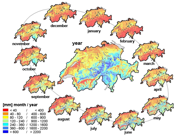
The dataset package is used in particular to estimate runoffs for unmeasured areas. Altogether, 13 datasets are available - one for the mean annual and 12 for the mean monthly runoffs. For each raster cell (500 x 500 m), a dataset indicates the mean natural runoff for the period 1981-2000.Information on the derivation of the dataset, the scope and limits of application, and the expected accuracy can be found in the following article (in German):
Die mittleren Abflüsse über die ganze Schweiz (PDF, 686 kB, 25.01.2008)Ein optimierter Datensatz im 500×500 m Raster
Ordering the dataset
The dataset can be downloaded free of charge by clicking on the below link.
The zip-file made available contains the dataset itself, the conditions of use, the recommended form of citation, metadata and the description of the dataset. It also provides indications on the fields and limitations of applications as well as some hints regarding the accuracy of the data.
Last modification 17.12.2019

